Coastal Monitoring
Remote Drifting & Fixed Environmental Sensor Platforms
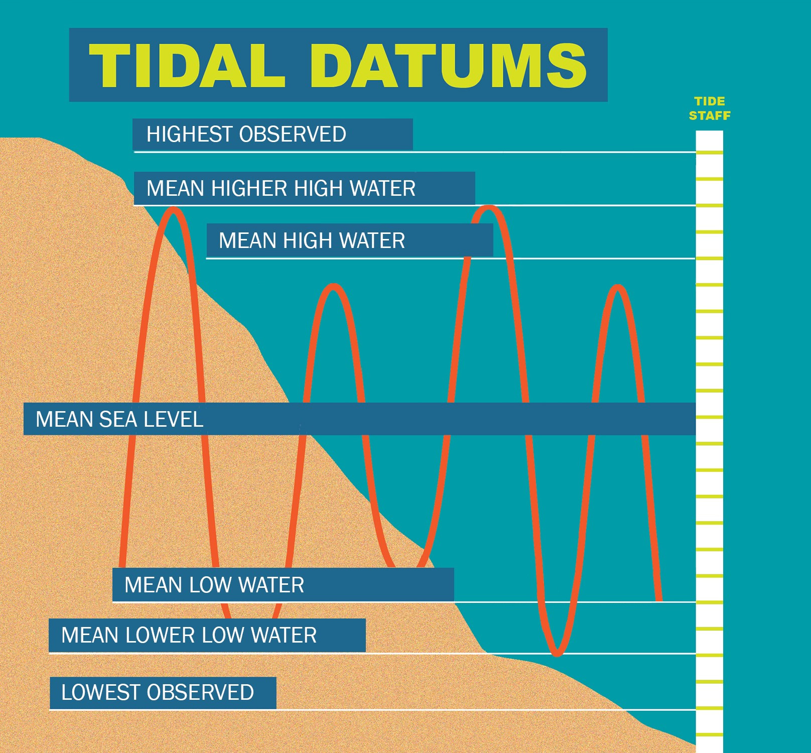
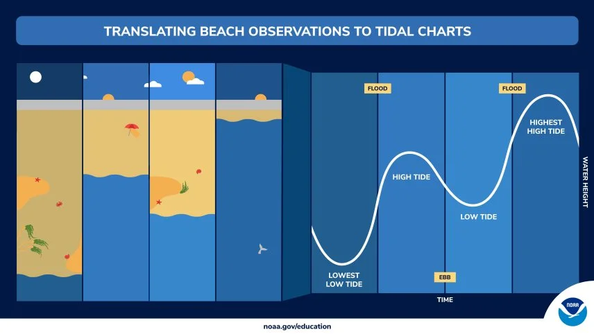
Understanding Tidal Dynamics of our Changing coastal environment.
Overview
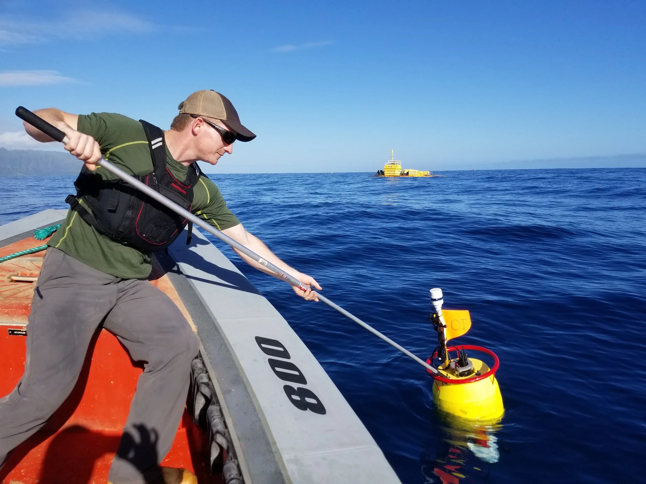
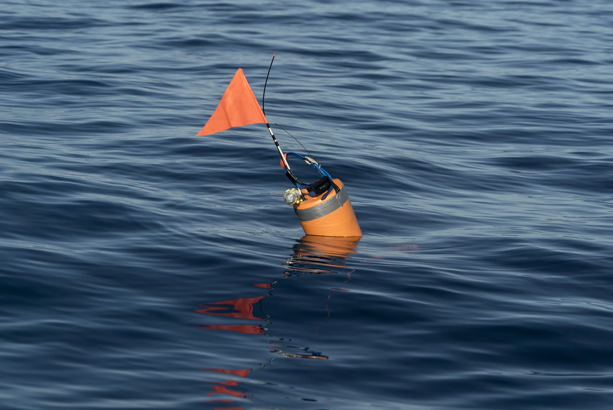
Drifting sensors introduce motion, unpredictability, and live environmental storytelling. Once deployed in water, these systems move, transmit, and reveal how currents, tide, geography, and obstacles influence path and conditions.
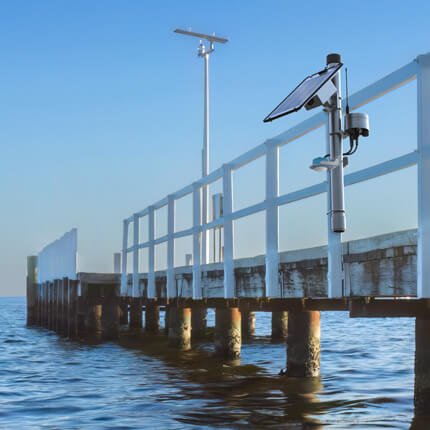
Dock, Pier, and Moored Monitoring Units - Provide Stable Reference Systems. Where drifting sensors introduce movement, dock, pier, and moored units introduce stability. These systems create a reference point within a changing environment and help students understand what is happening at one known location over time.
What students do
Design and build deployment units including housing, protection, mounting, and recovery considerations.
Engineer successful durability, protection, maintenance, power, recovery, and servicing.
Explore power options including battery and solar-assisted systems for longer-term deployments.
Customize and name their stations, creating a sense of ownership over a “home base” monitoring system.
Evaluate how design choices affect durability, visibility, and long-term performance in real conditions.
Design, name, and customize their drifting units, including flotation approach, visibility.
Deploy floating sensors into the water, deploy fixed or moored units at docks, piers, or other reference points.
Track path, speed, and changing environmental conditions in real time and over time.
Compare stable location readings with moving readings from drifting sensors.
Predict where a unit might go and compare predictions with actual behavior, trends, variations, and anomalies.
Analyze changes in path relative to tide, geography, and local conditions.
Compare one drift with another under different environmental conditions.
What students learn
Stable reference points are essential for comparison and interpretation.
Field systems often require thoughtful power design, including energy use, storage, and renewable supply.
Tradeoffs between size, power, and duration influence how mobile systems are designed.
Good field engineering includes durability, consistency, and maintainability.
Stable reference points are essential for comparison and interpretation.
Longer-term data reveals trend and pattern that short snapshots can miss.
A fixed frame and a moving frame each reveal different truths, movement is data.
Environmental forces become visible when a sensor moves through them.
Path, time, location, and conditions can be interpreted together.
Unexpected outcomes are not failures; they are new data for critical thinking.
How this module integrates with the portfolio
These units data connect directly to drifting sensors in real-time, tidal monitoring, data dashboards, and long-term environmental interpretation. They help students distinguish baseline conditions from temporary variation.
Drifting sensors gain meaning when compared with dock and moored stations, tidal cycles, GPS mapping, and weather conditions. They are often one of the most exciting modules because they make invisible water movement tangible and memorable.
High-engagement moments
Watching a live path unfold on a map.
Seeing a sensor slow down, speed up, or turn unexpectedly.
Connecting movement to tide, wind, and geography.
Understanding what 'normal here' looks like.
Finding an anomaly and asking what caused it, turning curiosity into explanation.
Comparing fixed and drifting measurements side by side