GPS - Satellite Based Global Positioning System
How we find our way in 2026
Overview
Students explore location, movement, routes, distance, and environmental mapping through GPS technology discovering how location influences environmental conditions and how dynamic positioning and mapping helps tell scientific stories.
GPS gives students a powerful way to connect measurements to place. It turns data into maps, paths, routes, speed, and time-based understanding. This module is highly age-adaptable: younger students can in fun ways learn location, direction, routes, and simple mapping; older students can analyze movement, coordinate systems, speed, timing, and spatial comparison.
What students do
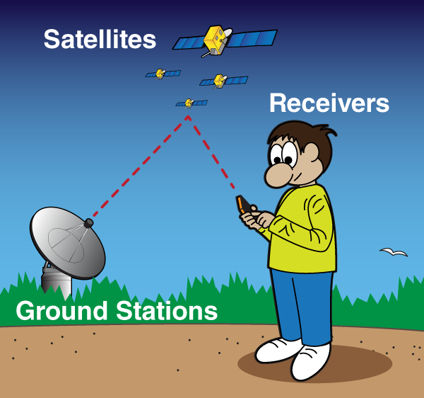
• Learn how satellites, timing, and receivers work at an age-appropriate level.
• Record location, movement, distance traveled, and route history.
• Map where readings were taken and compare one place with another.
• Use GPS with drifting sensors, portable field units, and environmental surveys.
• Explore concepts such as accuracy, signal conditions, and why positioning can vary.
What students learn
• Location matters in science and engineering.
• Mapping makes environmental patterns easier to understand and explain.
• Movement can be measured, visualized, and compared.
• Time and position together create a much richer picture than a single reading.
How this module integrates with the portfolio
GPS strengthens drifting sensors, mobile weather mapping, route-based investigations, geotagged hydrophone recordings, and time-synchronized environmental comparisons. It also supports data storytelling because students can see where their observations came from.
High-engagement moments
• Watching a real route appear on a map.
• Comparing two locations that looked similar but measured differently.
• Seeing speed and path change with current or terrain.
• Understanding that place is part of the data.